I've run some miles and enjoyed hikers' smiles...
The highlight of my week was a venomous treat!
Here's it is with fangs that are hollow. After this photo my post will follow...
 |
| Another "local" trail lover from the Laurel Highlands |
Since my last post I've put in a few days. The running I've done has been training efforts to get ready for a 5K coming up next weekend and anattempt at completing a LHHT double (140 miles) this fall or at the latest next spring. I've been doing a little speed conditioning for the Laurel Hill 5k (my only "race" this year) as well as some quality trail time with my son (now that he's home for a couple of days). Training for both efforts doesn't seem to be meshing well. My trail legs can barely turn over the necessary amount to produce even a 6:45/mi. 5k. I'd like to do well in my one and only race this year, although I highly doubt I will. The cool thing is that it's a mellow road race (through the woods). The proceeds help support the park which in turn indirectly helps the LHHT.
RECENT TRAINING:
8/2/13 Mt. Pleasant Coal and Coke Trail
Basic tempo run on a local rail trail that seems to be growing in popularity. It's not the most scenic, but does contain nice habitat which usually provides me with some good birding while running. 10k in 44:40
8/4/13 Laurel Highlands Hiking Trail (LHHT)SOBO
It was Saturday night and the weather for Sunday was predicted to be amazing. Mid 70°'s with a 10% chance of rain. It would be perfect day for a long run. I was feeling the "after burn" in my quads from that tempo run on Friday, but couldn't resist these prime conditions. Laura mentioned that Sunday would be a rest/non running day for her and I kindly asked if she would mind supporting me for a long point to point run. She said she'd be happy to help and we set off to prepping and planning.
 |
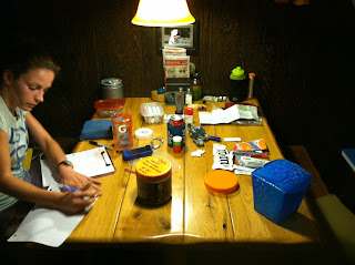
| Laura writing the itineraryand helping me pack |
 |
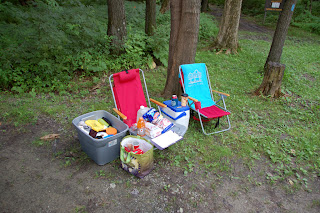
| Trail Love - typical drop can containing a couple hours or more of fueling |
My last long run was northbound, commonly calledNOBOin trail lingo. Last week I ran from Ohiopyle to Hickory Flats Road (38 miles), stopping due to bruising on the ball of my left foot. This time we would switch it up. Laura would drop me off in Seward at the northern terminus of the LHHT and I would run in a southbound direction or SOBO. We've found running the trail in this direction makes it easier to crew one another. We usually put drops of food and water at Rt. 271 (highway not parking lot) on the way up and another at Rt. 30 while the crew person is on the way home to kill about 6 hours. This prevents having to meet the runner until over half way at (39miles) Rt. 31 parking lot. The distance from the main trail to the parking area is very short and favorable to meet crew and resupply. From there we take it as it goes. I'll get into that shortly.
The alarm went off at 4:15AM. We were basically packed and ready to hit the road. I pressed some kick ass coffee for the road while Laura made PB&J's for the drop cans and out the door we went. We placed the Rt. 271 resupply and headed to the trail head in Seward. On the drive over we were treated to star filled skies and a crescent moon just as the forecast predicted. We were there by 5:45AM. Just enough time for a 6:00 start. I quickly got ready and received a loving send-off at 6:00 sharp.
 |
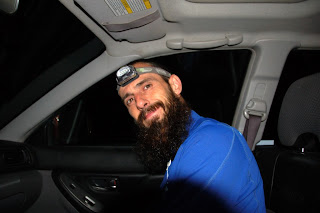
| Putting on my headlamp for the start |
 |
| A few minutes to start |
 |
| Its GO time, out like a |
I was definitely feeling the tightness in my legs for the first couple miles. My tempo workout wasn't the best prelude to a long or possible thru-run. I wasn't feeling optomisitc or fast out of the gate and figured I'd at least get in a 50k training run on a beautiful day. I ran/hiked a couple sub 12's up the intial climb. I stopped at the power line crossing to snap this quick photo.
 |
| The power line crossing out of Seward on the LHHT |
Shortly after my photo, the brief glimpses of sky through the canopy in the Northwest looked ominous. Where was my sunshine filled happy morning? 10% chance of rain? By the gravel road at mile 6 it was bucketing rain. What's worse than the gravel road section of the LHHT? Running it in a cold, hard, rain... For two hours it rained. Thankfully mother nature provided plenty of wet weather training last month and I was well prepared for the soaking I received. Here's the radar image that Laura texted me not long before the rain started. The only storm around and it was on track with me!
 |
| Laura's image and text. "Sorry, hope you stay dry" |
 |
| Looking up at the Ridge from the West near Rt. 30, photo L. Hahn |
Thankfully I ran out of rain somewhere between Rt. 271 and Rt. 30. Both resupplies went well. Both stops combined cost me about 7min. I ate PB &J's from drops while I ran. Each drop can contained a handful of M&M's, a PB&J sandwich in foil (I find the foil acts as a "plate" while eating and running), gels, and Elete rehydration tablets.
 |
| Rt. 30 drop in place thanks to Laura |
When eating solid foods while running I try to adopt the same practices as when eating a gel on the run. Small bites over a mile or two, sipping water to help wash it down. I was making good time and right on track with my estimations despite resupply stops and 1 call to nature. Hydration was going great. I was urinating regularly and clearly. I was averaging one handheld (21oz.) of Gatorade per hour supplemented by plain water and Elete Tablytes, and a gel (GU,Cliff, etc.) both at about 1tab and gel per hour).
 |
| I still smile every time I cross the NEW turnpike bridge. |
During the 15 miles from Rt. 30 to 31 I started to bonk from dehydration and not enough calories. I realized and started the process of hydrating and fueling. I was well on my way to better pulling into Rt. 31 trail head to meet Laura for the first time of the day. I was still on schedule, but noticed a slight pain on the top of my foot. I believe this was due to an overtightned shoe lace while sliding around in the rain. Aware but not overly concerned, I loosened my lace areas affecting the sore spot to minimize the pressure and further issues. My break at 31 with Laura wasmuchlonger than my 4 minutes at the Rt. 271 and 3 minutes at Rt. 30 drop. I basically stopped and had a picnic. I just want to point out that this is why training runs are so much cooler than high dollar races! No crowds, no pressure, just pure fun and running for the love of it.
 |
| Mid run picnic anyone? |
 |
| Laura ready anxiously waiting to run with me |
It was delicious. I ate a ham and chese sandwich, baked potato, a few pretzels, anddrank some chocolate milk and coffee. This was no ordinary aid break. We're talking an hour or so ;) After our picnic, Laura joined me in running about 3 miles before saying goodbye and turning back towards 31. Her next stop would be Rt. 653 trail head. We met there and I picked up a refill on supplies and my headlamp ate some more and hung out longer than normal.
 |
| Rt. 653 trail head, a happy trail runner |
By this point I was far off my schedule for the time of day, but still on pace as far as speed of travel goes. My foot was getting worse, but It still didn't seem enough to stop and I was enjoying the run. My legs were hanging tough and were feeling great. I took off from Rt.653 trail head and was running smooth. The sun was setting near Cranberry Glade and the lake was like glass. I decided to stop for a photo and to put on my headlamp.
 |
| Cranberry Glade at sunset |
The rest of the run to Maple Summit Road crossing went well and I met Laura sitting in the dark. By this time the bruising had become enough to call my training run done. I love running in the dark and Maple Summit Road to Ohiopyle SOBO might be my favorite section of the entire trail. A bit of a bummer, but not worth the risk of ruining my training. I need to remember I've only been back running for a short period of time. The run went well and I had the best conditions and support for a 60 mile trainer.
 |
| The End |
Distance: 60 miles
Run Time (without picnic): 12:36
Pace: 12:36/mi.
Elevation gain 5,000', loss 3,800'
8/6/13Laurel Summit State Park,Wolf Rocks trail loop
Went for a 4.5 mile run with Laura. My instep was still sore from my 60 miler, but the day was beautiful and I couldn't pass up a run with my Sweetie. I laced and tied my shoes very loose for this easy run. A fun run out to the overlook and back on the loop. Lots of mountain bikes out enjoying the weather as well.
Distance: 4.5 miles
Duration:50:55
Pace 11:19/mi.
Elevation - not much
8/7/13 Iwent for a 5.5 mile hike with my son Skyler and we were fortunate enough to see these beauties along the way.
 |
| Yellow Phase Timer Rattlesnake |
 |
| Black Phase Timber Rattlesnake |


 |
| Someone is seriously excited to see some Rattlers especially the one behind him... Can you find it? |
8/9/13LHHT Route 31 NOBO with Granola the trail dog
I set off yesterday to get in a couple hours running on the trail. I decided it would be a good day to take our trail dog "Granola". He was excited to go and we drove to Rt. 31 trail head. The skies were dismal, but we set off at a decent 9:00/mile pace and only made it out about 2 miles before the rains hit. Once again I found myself plodding along through a downpour, this time with my dog in tow. The trail quickly turned into a stream and in many low areas the water/mud was so deep Granola would bottom in swamp water up to this torso. We kept going a few more miles until enough was enough. We turned around about 3.5 miles out and continued our efforts back to the car. Granola was getting a little tired on the way back, so we slowed pace a little, but still made good time considering trail conditions. He assured me he had a blast once back at the car. We toweled off and made our way home to dry out!
Distance: 8 miles
Duration: 1:10
Pace: 8:45/mi
 |
| Help... I've about drowned in a river that didn't exist an hour ago! |
.JPG) |
| The road to 31 trail head after the storm was ending... |
8/10/13LHHT Route 653 NOBO
Spent another glorious day our hiking with my son Skyler. We decided to hike north from 653 trail head out to Middlefork overlook. The weather was perfect and we enjoyed a nice relaxing walk out to the overlook, hung out a few minutes and hiked back to the car. Awesome hike with one of my favorite hiking partners.
Distance: 5.4 miles
Duration: 1:35:53
Pace: 17:33/mi.
.JPG) |
| Littleman at Middlefork over look |


 Sunset from the Bridge. Sebastian Inlet. December 9, .. 5:09 pm
 Sunset from the Bridge. Sebastian Inlet. December 9, .. 5:21 pm
 The road now a river
 The work of beavers
 View from the bridge
 Largest trillium I have ever seen
 Needle carpeted trail
 On the afternoon of Tuesday, July 1, a climber fell approximately 15 feet into a crevasse at around 11,400 feet on the Kautz Glacier of Mount Rainier while descending the Mountain. The injured climber, Mitchell Bell, was rescued from the crevasse by his four teammates. Bell had injured ribs and visible lacerations to his head and face, but he was conscious and in stable condition. A doctor in the team quickly determined that due to his known and potential injuries, Bell could not continue the descent without assistance. Two members of the party climbed down in search of help, leaving the doctor, another teammate, and the patient at the scene. Back at Camp Hazard about 1,000 feet below, they found Alpine Ascents International (AAI). Several AAI guides responded to the request for assistance and contacted the National Park Service. A plan was put in place for two AAI guides to travel to the accident scene that evening to assess the injured climber’s condition and bring with them materials for an overnight stay on the Mountain. Based on their assessment, the Incident Commander, David Gottlieb called for air-lift/hoist extraction the following morning.
 Within an hour of take-off on Wednesday morning at approximately 6:45 a.m., a US Army Reserve Chinook helicopter from Fort Lewis successfully extracted the injured climber from the Kautz Glacier. The patient was transported to Madigan Hospital for further medical evaluation. He was released later that day.


